Holly Beach – Ocean View Beach
Shoreline Stabilization Projects
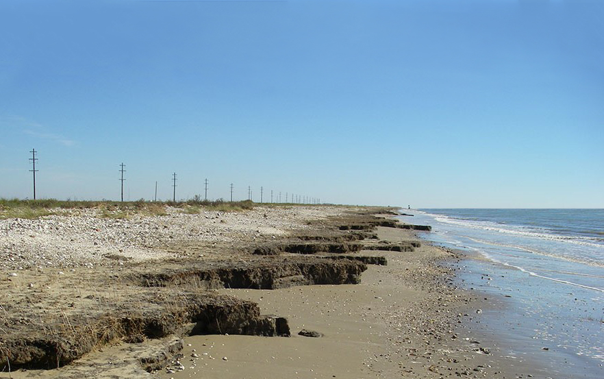
An important transportation artery and hurricane evacuation route, Louisiana State Highway 82 parallels the Gulf of Mexico shoreline and is subject to high rates of wave-induced erosion. Between 1963 and 1990, approximately $600,000 per year was being spent by Louisiana Department of Transportation (LDOT) on repairs, and the problem was becoming increasingly critical. The highway had been relocated inland several times to contend with shoreline retreat and is now set on a chenier ridge, which also serves as the last barrier between the Gulf of Mexico and over 30,000 acres of fragile coastal marsh.
Employed by Brown & Root Civil in the early 1990s, Lally served as the coastal engineer on several feasibility studies and concept designs under contracts with Louisiana Department of Natural Resources for projects extending across the Louisiana coastal zone. Among these were two engineering studies that addressed shoreline erosion in Cameron Parish between Holly Beach and Constance Beach.
Requested to develop alternative stabilization concepts for this 17-mile segment of coastline, Lally performed analyses of shoreline morphology and coastal processes, estimated shoreline change and sediment transport rates, and identified socio-economic and environmental implications of the project through field visits and stakeholder engagement. Lally evaluated several coastal erosion control structures including revetments, groin fields, and breakwaters, variants of which LDOT had already tested on site, as well as more nature-based solutions including beach restoration, nourishment, and vegetative plantings.
The recommendation Lally put forth was for an integrated approach using both an expansion of a form of detached segmented rubblemound breakwater designed by LDOT, with beach restoration and long-term nourishment. Sixty-nine (69) additional breakwaters were estimated and recommended for about 6.6 miles of shoreline stabilization.
A refined design was proposed to increase the breakwater length-to-gap ratio in order to limit cross-shore wave transmission and sand loss, while locating the breakwaters just far enough offshore to promote the development of salients. In doing so, the project would realize more uniform shoreline stability, versus designing for tombolo development which would serve as sediment sinks and inhibit longshore sediment distribution. In concert with the expanded offshore segmented breakwaters, Lally also recommended beach restoration and periodic nourishment using locally available beach-quality sands.


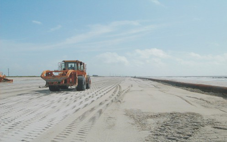
Lally coordinated with the U.S. Army Corps of Engineers – New Orleans District and Louisiana Geological Survey, to investigate potential sand sources within the Lower Calcasieu River (Bar Channel) Maintenance Dredging Project, as well as offshore deposits within the Sabine Bank, closer to the beach fill segments. Both borrow sources were found to be technically and economically feasible using either trailing suction hopper dredge (TSHD) or hydraulic pipeline dredges and put forward in our reports for further investigation in engineering design stages and as informed by a new littoral processes study Calcasieu Ship Channel being conducted by USEPA.
The Holly Beach to Constance Beach projects have since advanced to construction under different phases and funding sources. Most of the recommended measures have been implemented. In total eighty-five (85) detached breakwaters were constructed between 1990 and 1995 to protect 7.3 miles of coastline. Beach restoration was completed in 2002-2003 with 1.75 million cy of sands from the Calcasieu River employing the hydraulic dustpan dredge Beachbuilder. Working in concert these coastal erosion control projects inevitably contributed to limiting of the damage sustained by Highway 82 and the coastal marshes in their lee during Hurricane Rita in September 2005, and Hurricane Ike in September 2008. Another beach restoration project was completed in 2013-2014 along 9 miles of shoreline between the Calcasieu west jetty and Holly Beach. Approximately 2.0 million cy of beach-quality sand was mined from the Sabine Bank offshore borrow area and placed TSHD.
These integrated shoreline protection projects have performed effectively in reducing the frequency and extent of highway overwash and breaching during hurricanes, and the highway has consequently not required relocation.
Services Provided
Field Investigations
Shoreline Change Analysis
Investigate Shoreline Erosion Control Alternative
Concept Design of Detached Offshore Breakwater System
Investigate Beneficial Use of Dredged Material
Borrow Source Identification
Cost Estimation
Concept Planning Report
Location
Cameron Parish, Louisiana
Period
1991 – 1993
The Offshore Detached Breakwater System between Holly Beach and Constance Beach, Louisiana is the longest ever constructed in the United States. It’s 85 shore-parallel structures extend for 7.3 miles (11.7 km) and have served to significantly reduce the impacts on and maintenance required for Hwy 82 as reported by Cameron Parish and CPRA.